Laredo Landfill LOMR, Laredo, TX
Water Resources | Drainage
Role: Prime
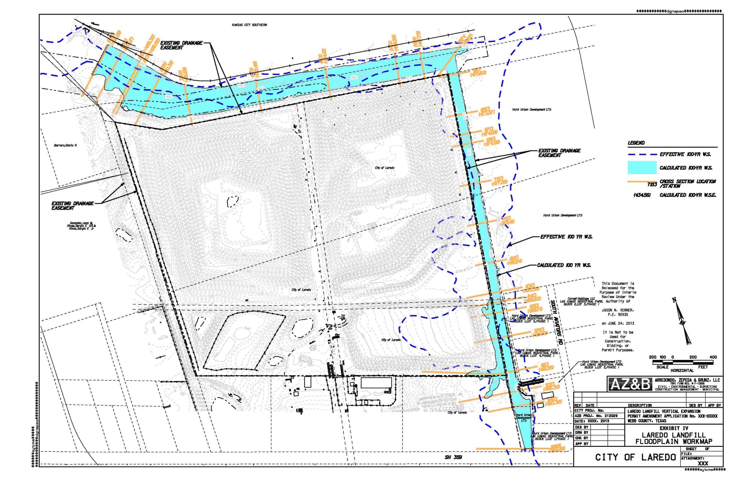
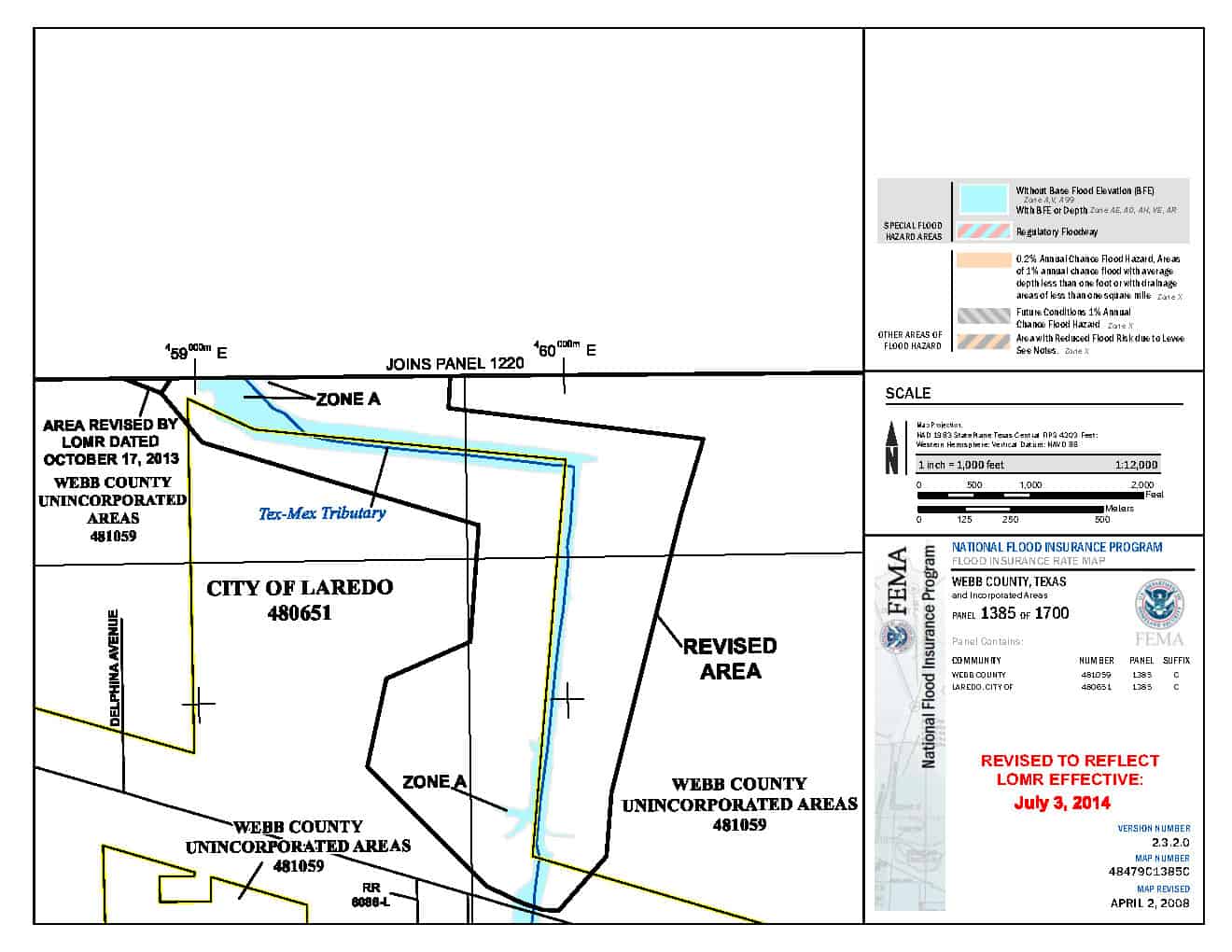
A proposed cell at the Laredo Municipal Landfill was located next to an unnamed tributary of Chacon Creek, with a corresponding Zone ‘A’ (approximate) floodplain. The latest FIRM showed the area of the new cell being flooded during the 100-year storm, which would result in the denial of a permit from TCEQ. AZ&B determined that the topographic data in the effective FIS model was outdated, inaccurate and conducted an aerial topographic survey of the creek floodplain along with its upstream drainage area. Based on the new land use data for the watershed, AZ&B created a new HEC-HMS model to determine the peak flow rates and utilized the new, more accurate topographic data to revise the effective FIS HEC-RAS model. AZ&B created existing and proposed condition models to depict the impact of the proposed landfill cell, which was negligible. AZ&B assisted the City of Laredo FPA in preparing the necessary LOMR paperwork to revise the effective FIRM based on the new model data. FEMA issued a new LOMR and the TCEQ permit was obtained.
Construction Estimate
$4.1 million
Services
- Floodplain Modeling
- HEC-HMS Model (NRCS Method)
- HEC-RAS Model
- FEMA Zone ‘A’ Crossing
- Topographic Survey
- Drainage Analysis
- FEMA Map Revisions (LOMR)
- Technical Report