Dallas Water Utilities Dam Breach, TX
Water Resources | Drainage
Role: Subconsultant
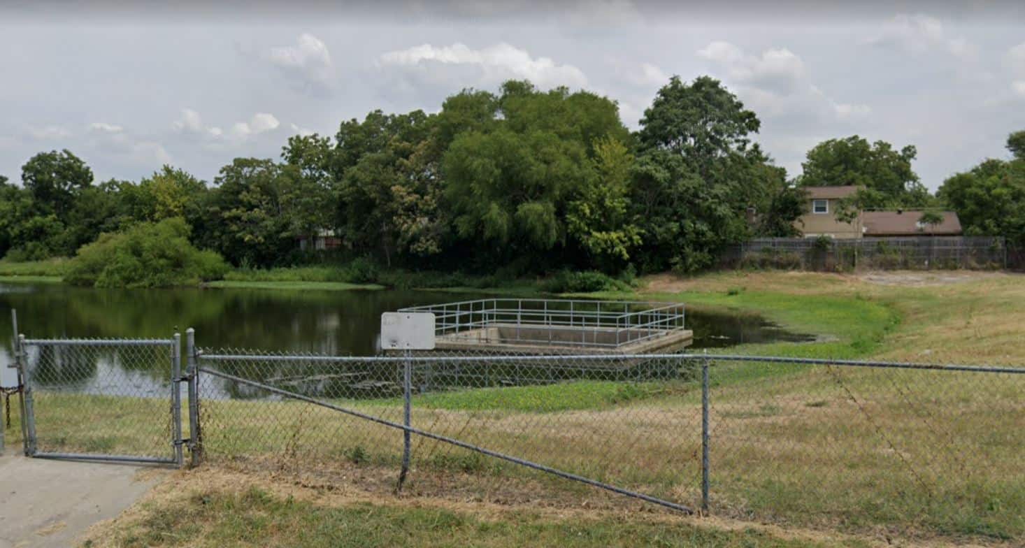
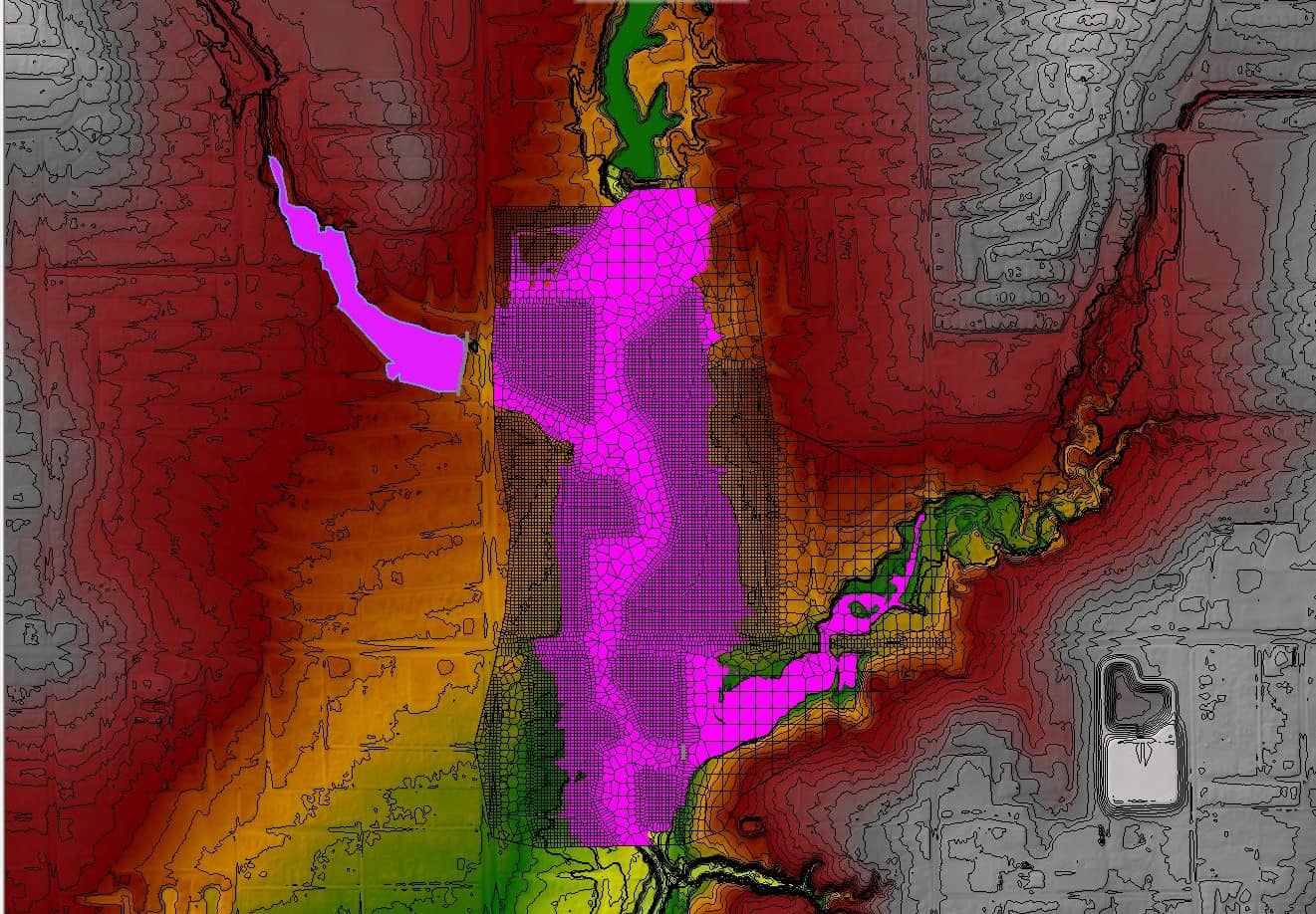
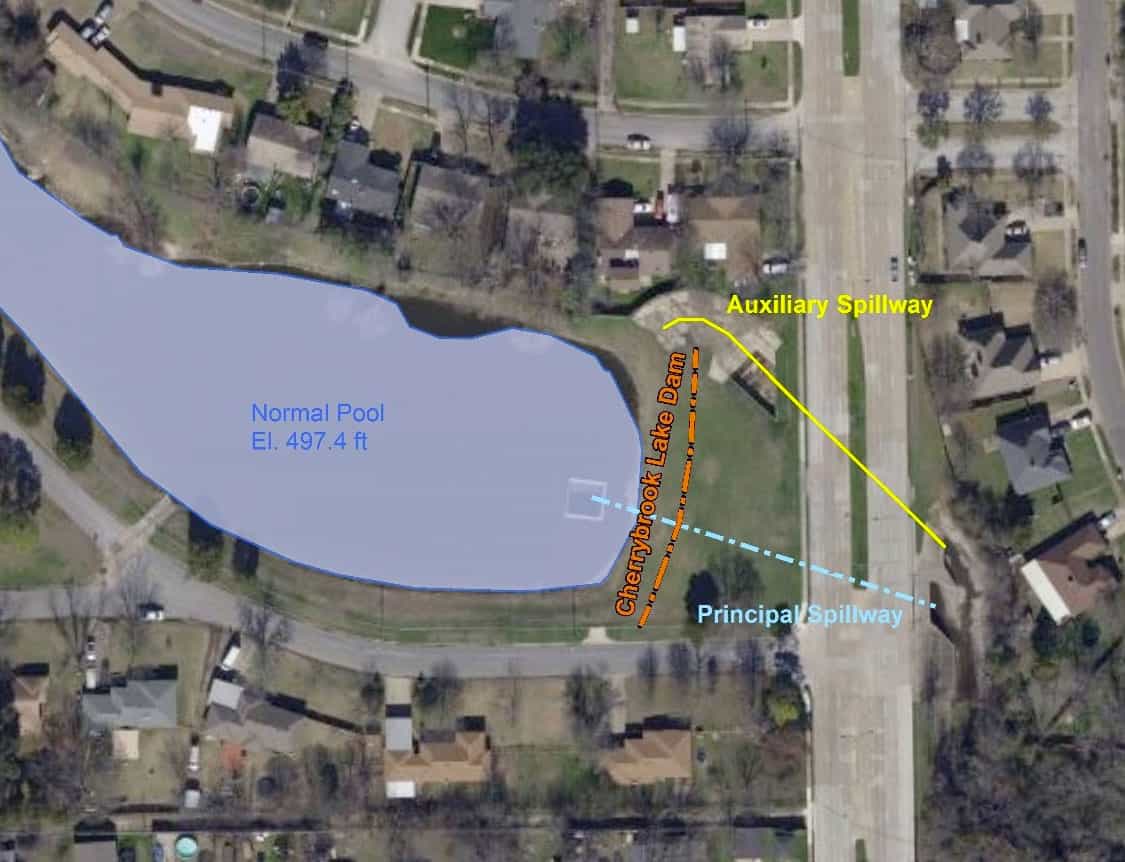
AZ&B performed a two-dimensional (2D) dam breach analysis for Cherrybrook Lake Dam. Work included importing NCTCOG topographic data and NLCD (land cover data) into HEC-RAS and assigning Manning’s ‘n’ values to each land use classification. A 2D mesh was created in RAS Mapper and defined the storage area (SA) parameters for Cherrybrook Lake. A SA/2D area connection was used to model the dam and create an outlet rating curve to compositely simulate the primary and auxiliary spillway functions. Boundary conditions were added, including inflow hydrographs for Cherrybrook Lake and nearby Lake June. Three dam breach scenarios were modeled per TCEQ guidelines including Probable Maximum Flood Breach (PMFBR), Barely Overtopping Breach (BOTBR), and Sunny Day Breach (SDBR). In their evaluations, the models were reviewed and refined accordingly. A RAS Mapper was utilized as a post-processor to provide GIS mapping data for inclusion into their Emergency Action Plan for eleven dams across the City.
Services
- 2D Dam Breach Analysis
- H&H Modeling